Introduction
Aerial photography is often associated with marketing visuals, real estate listings, or cinematic footage. While those use cases are well known, they represent only a small part of how aerial imagery is actually used in professional environments. In many industries, aerial photography has become a practical tool for visual documentation — one that helps professionals understand sites, surfaces, and conditions before making any decisions.
At its core, aerial photography is about access to perspective. It allows people to see areas that are difficult, time-consuming, or risky to view from the ground. More importantly, it allows them to see these areas clearly, consistently, and without disrupting ongoing operations.
For professionals who rely on accurate information — property managers, engineers, construction teams, consultants — this clarity matters far more than aesthetics.
From “Nice Images” to Useful Visual Data
In a professional context, aerial photography is not about creative angles or dramatic motion. The goal is to capture reliable visual data that can be reviewed, shared, and referenced later. Images are taken deliberately, following planned paths and angles, to ensure that nothing important is missed.
This approach transforms aerial photography from a visual enhancement into a functional layer of information. Instead of guessing based on partial views or outdated photos, professionals gain access to current, high-resolution imagery that reflects real conditions at a specific moment in time.
Seeing More Than the Ground Allows
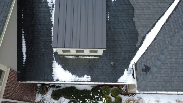
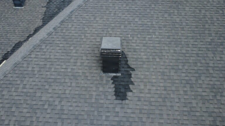
Ground-level photos are limited by perspective. Even when taken carefully, they often show only fragments of a larger picture. Aerial imagery, on the other hand, reveals context. It shows how different elements relate to one another, how surfaces behave as a whole, and where visual patterns emerge.
For example, on large commercial properties or rooftops, aerial photos make it possible to understand layout, scale, and surface continuity at a glance. What might take dozens of ground photos to approximate can often be captured in a single, well-planned aerial sequence.
Visibility That Supports Better Professional Judgment
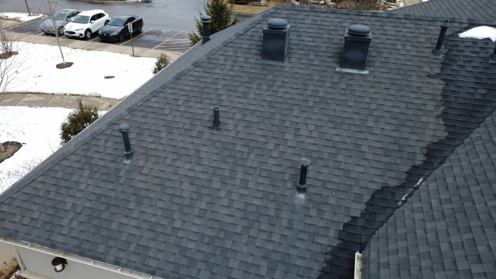
One of the key advantages of aerial photography is the level of visibility it provides. Modern equipment allows for detailed surface views, clear documentation of transitions, and accurate representation of spatial relationships. This makes the imagery especially valuable for professionals who need to review conditions remotely or prepare for on-site work.
Rather than replacing expertise, aerial imagery supports it. Licensed professionals can analyze visuals in advance, identify areas that warrant closer attention, and approach physical site visits with better focus and preparation.
Reducing Risk and Disruption
Accessing elevated or hard-to-reach areas often introduces safety concerns. Ladders, lifts, and scaffolding increase risk and can disrupt normal operations, especially on occupied properties or active job sites.
Aerial photography reduces the need for immediate physical access. In many cases, it allows teams to gather the visual information they need without anyone stepping into hazardous environments. This does not eliminate the need for hands-on work, but it ensures that such work is purposeful rather than exploratory.
Who Benefits Most From Aerial Visual Documentation
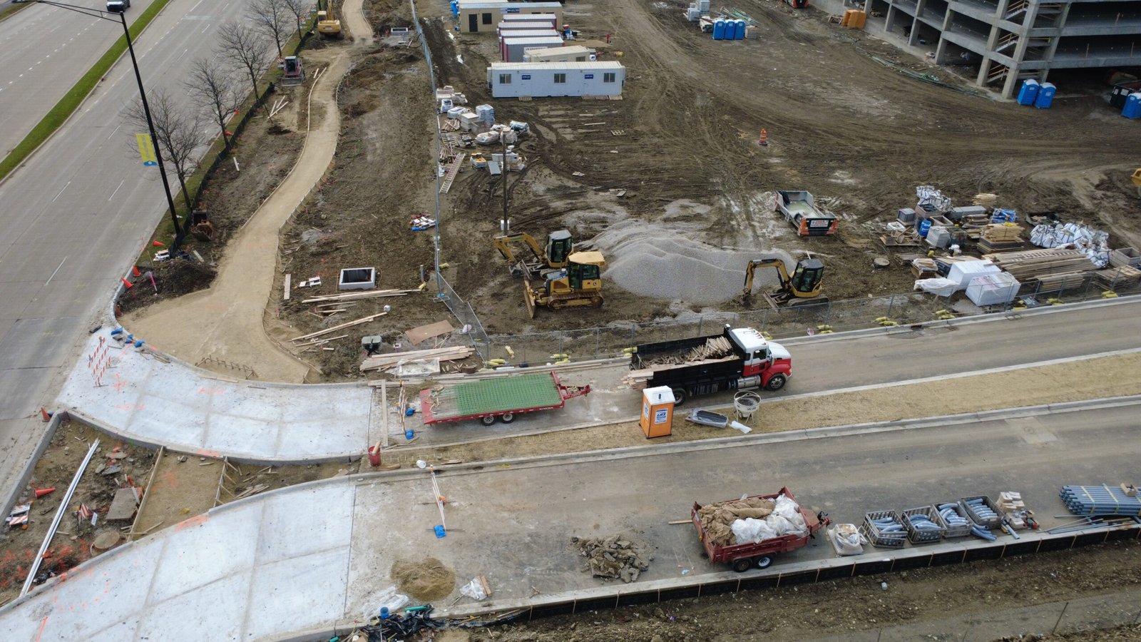
Aerial photography is particularly valuable for professionals whose decisions depend on clear visual understanding. Property managers use it to document conditions and communicate with vendors. Engineers and consultants rely on it to gain context before evaluations. Construction teams use it to track progress and maintain transparency with stakeholders.
In each case, the imagery serves the same purpose: it provides a shared visual reference that improves communication and reduces uncertainty.
When Aerial Photography Makes Sense
Aerial photography is most effective when sites are large, complex, or difficult to access. It is especially useful when documentation needs to be repeated over time or shared across multiple teams. In these situations, the value lies not just in what is captured, but in how consistently and clearly it can be reviewed later.
Rather than being a one-time asset, aerial imagery often becomes part of an ongoing documentation process.
A Practical First Step, Not a Final Answer
It is important to understand that aerial photography does not deliver conclusions. It delivers visibility. All evaluations, assessments, and decisions are still made by qualified professionals using their expertise.
By starting with clear, comprehensive visuals, those professionals are simply able to work more effectively. They spend less time orienting themselves and more time applying their knowledge where it matters most.
For many organizations, this visual-first approach has become the most practical way to begin complex workflows — not by assuming, but by seeing.
Disclaimer
We provide aerial visual documentation only.
We do not perform inspections, evaluations, or certifications.
All professional assessments and conclusions are made by licensed specialists using the documented imagery.