Introduction
When people first consider aerial photography, they often compare it to what they already have: photos taken from the ground. These images may have been captured with a phone, a camera, or even professional equipment, and in many cases they are perfectly adequate. Ground photos are familiar, accessible, and easy to produce, which is why they remain the default option for visual documentation.
However, as soon as a site becomes larger, more complex, or harder to access, the limitations of ground photography begin to surface. The difference between ground photos and aerial visual documentation is not just a matter of height. It is a fundamental shift in perspective, context, and usefulness.
Why Ground Photos Often Feel “Incomplete”
Ground photography is naturally constrained by where a person can stand. Walls, equipment, elevation changes, and safety considerations all limit what can be captured. Even with careful planning, ground photos tend to focus on individual details rather than the full picture.
As a result, stakeholders reviewing these images often struggle to understand how separate photos relate to one another. Important context is missing. Orientation is unclear. Scale is difficult to judge. The viewer sees pieces, but not the whole.
This fragmentation is rarely intentional, but it is almost unavoidable when documentation relies solely on ground-level access.
What Changes When the Camera Moves Above the Site
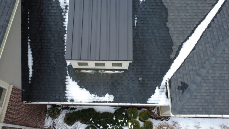
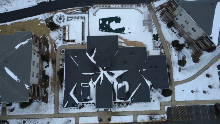
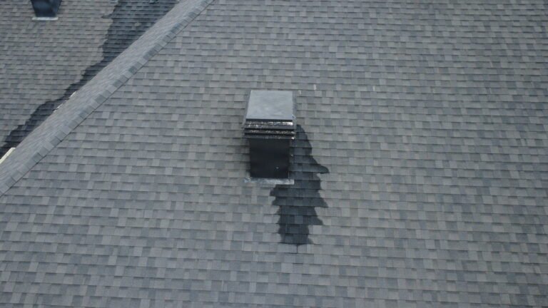
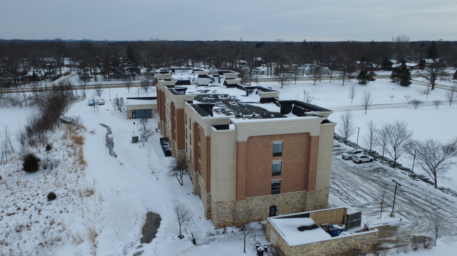
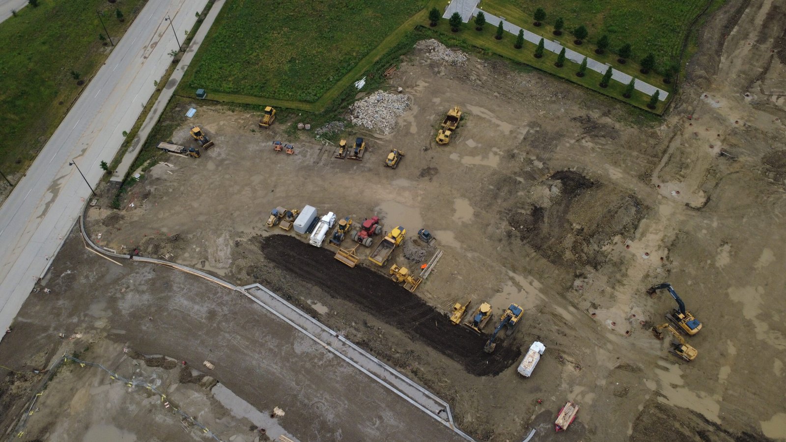
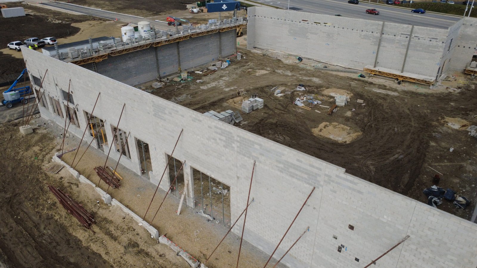
Aerial visual documentation introduces a perspective that ground photos simply cannot replicate. From above, surfaces, layouts, and spatial relationships become immediately clear. Instead of guessing how different areas connect, professionals can see those connections directly.
This change is especially noticeable on rooftops, commercial properties, and construction sites. Elements that appear isolated from the ground suddenly make sense when viewed from the air. Drainage paths, access routes, surface transitions, and overall organization become visible in a way that ground photos rarely achieve.
Context as the Missing Link
One of the most valuable aspects of aerial imagery is context. Aerial photos show not only what is present, but also where it is located in relation to everything else. This spatial awareness is critical for professionals who need to interpret conditions rather than simply observe details.
With aerial documentation, images stop being standalone visuals and start functioning as part of a coherent visual map. This makes them far easier to review remotely, share with colleagues, and reference later.
Consistency Over Time
Another key difference between ground photos and aerial documentation is consistency. Ground photos are often taken from slightly different positions each time, even when efforts are made to recreate angles. Over time, this makes comparisons difficult.
Aerial documentation can be captured using repeatable paths and viewpoints. This allows professionals to compare images taken weeks or months apart and clearly see what has changed. In long-term projects or ongoing property management, this consistency transforms photos into a reliable visual record rather than a collection of snapshots.
Safety and Efficiency Considerations
Ground photography at height often requires ladders, lifts, or other access equipment. These methods increase risk and extend the time required to gather documentation. They may also interfere with normal site operations.
Aerial photography reduces the need for this initial physical access. Visual information can often be gathered quickly and safely, allowing teams to decide whether further on-site work is necessary and where it should be focused.
How Professionals Use the Aerial Advantage
Property managers rely on aerial visuals to communicate clearly with vendors and consultants. Engineers and specialists use them to prepare for site visits and focus their attention more effectively. Construction teams use aerial documentation to track progress and align stakeholders around a shared visual understanding.
In each case, the value of aerial imagery lies not in replacing existing workflows, but in strengthening them.
When Ground Photos Are Still Enough
It is worth noting that aerial documentation is not always required. For small, fully accessible areas or tasks that depend on close-up detail, ground photos may be sufficient. The goal is not to replace one method with another, but to use the right tool for the situation.
Understanding when aerial photography adds meaningful value is part of making informed decisions.
A Complement, Not a Competition
The most effective documentation strategies often combine ground-level detail with aerial context. Together, they provide a more complete visual narrative than either approach alone.
By understanding what actually changes when moving from ground photos to aerial visual documentation, professionals can choose an approach that delivers clarity rather than complexity.
Final Thoughts
The difference between ground photos and aerial imagery is not about quality alone. It is about perspective, context, and the ability to see systems rather than fragments.
For many professional use cases, aerial visual documentation offers a clearer, safer, and more informative way to understand sites before decisions are made. It does not replace expertise — it supports it by making the unseen visible.
Disclaimer
We provide aerial visual documentation only.
We do not perform inspections, evaluations, or certifications.
All professional assessments and conclusions are made by licensed specialists using the documented imagery.