Case Overview
This project involved aerial monitoring of a construction site during the early preparation phase in Schaumburg, Illinois.
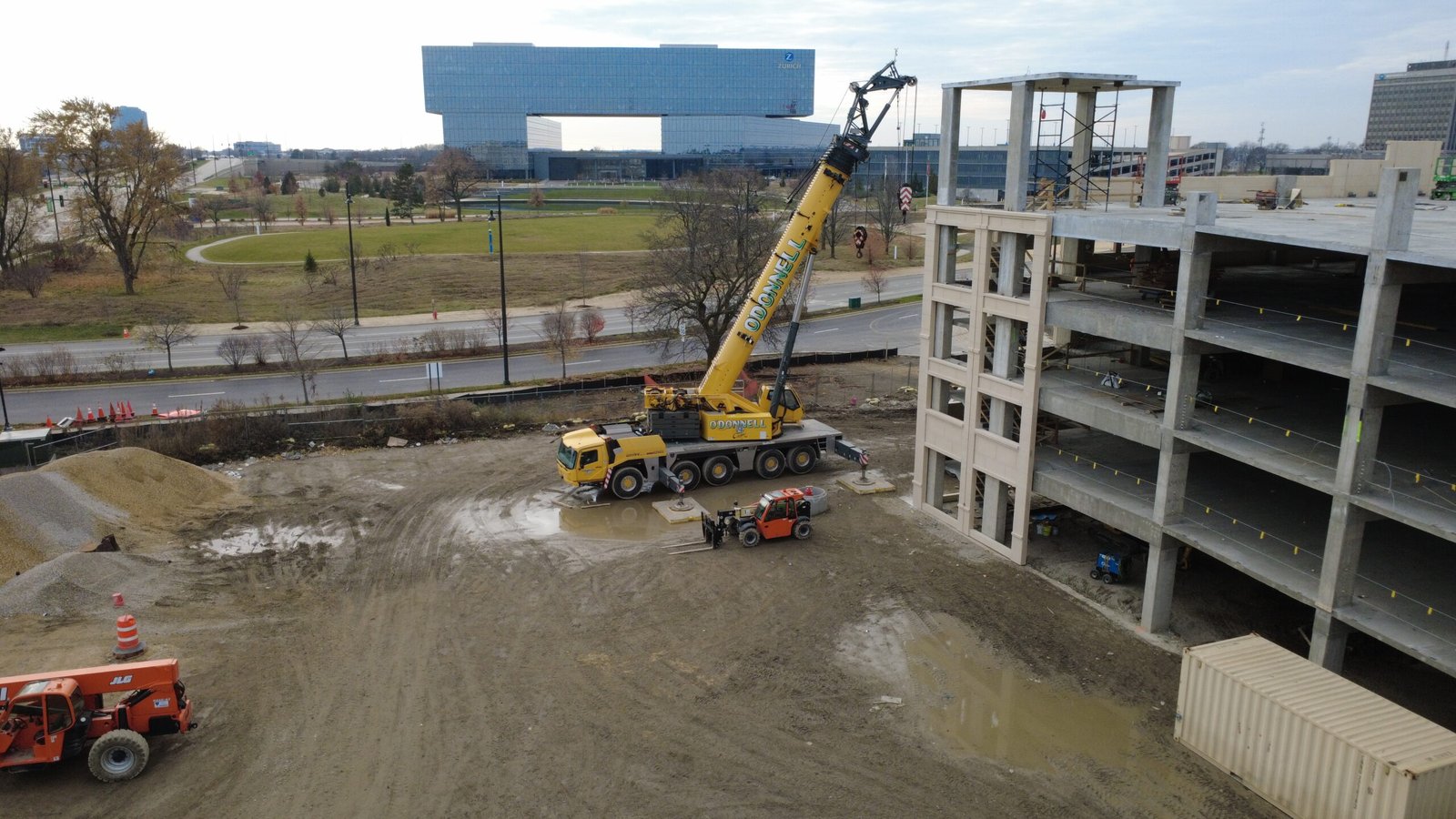
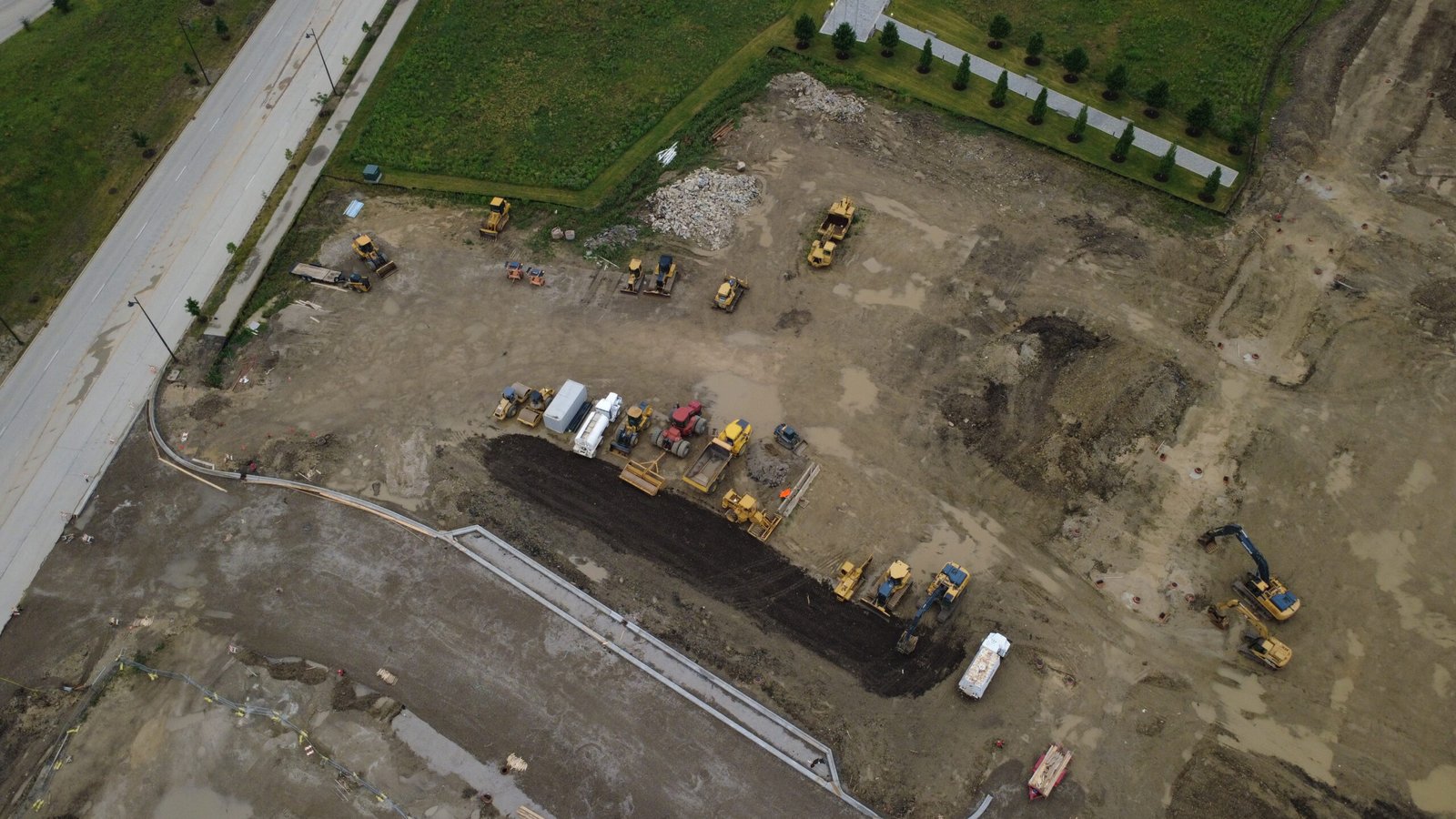
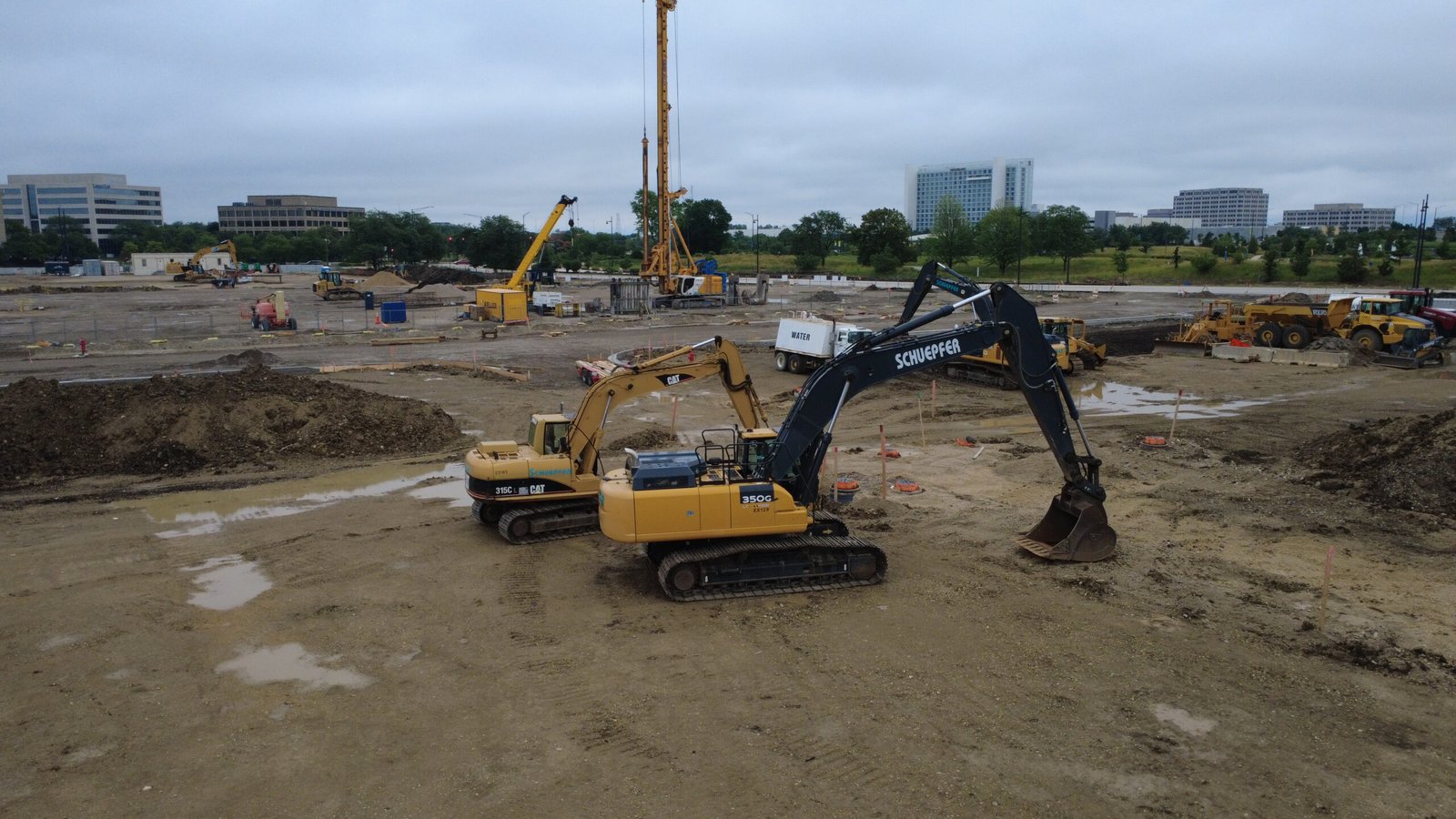
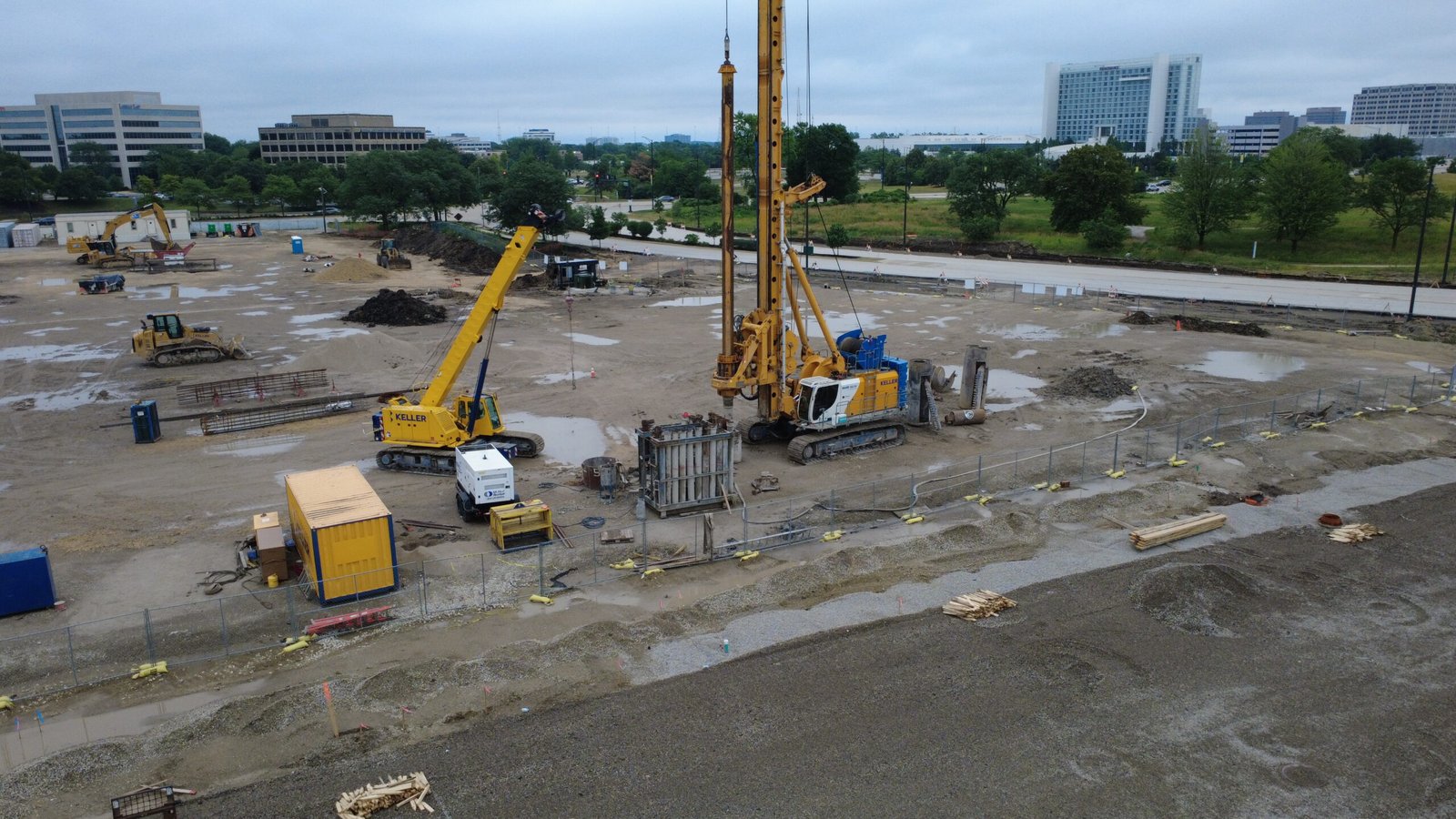
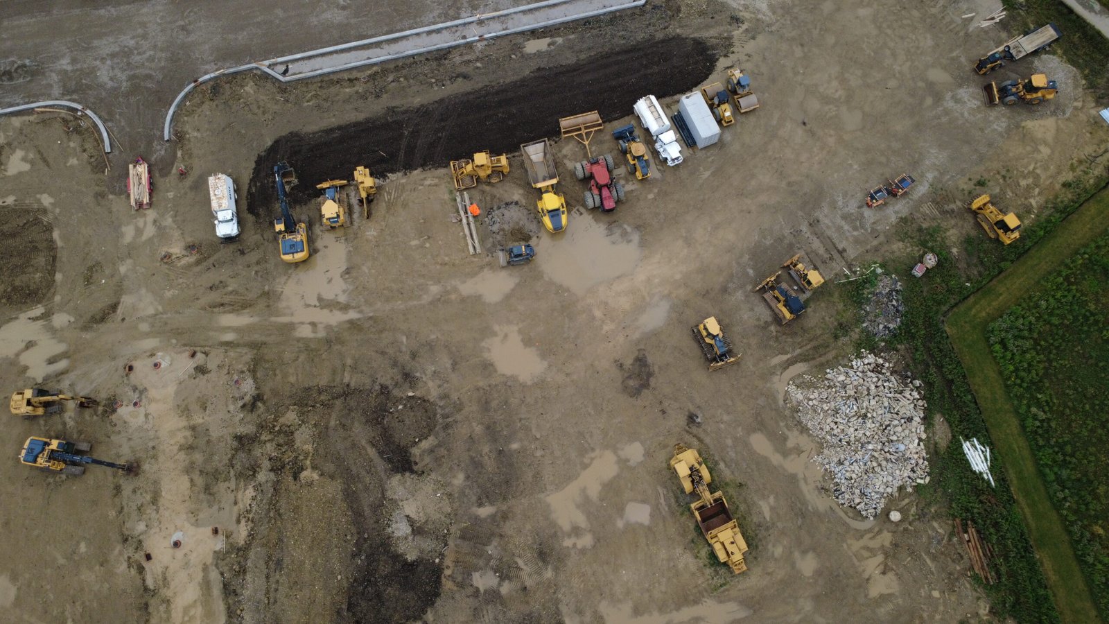
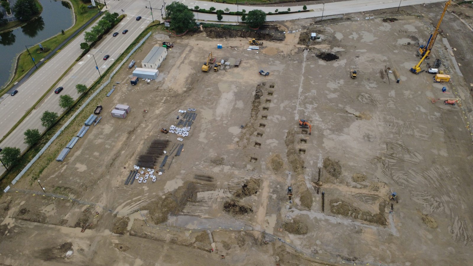
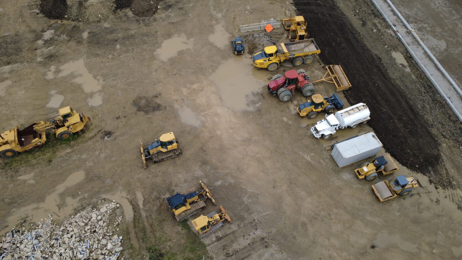
At the time of the flight, the site was undergoing land clearing, grading, and earthwork operations in preparation for future construction of a multi-building complex.
Aerial photography provided a clear view of site readiness, terrain shaping, and equipment activity, creating a visual baseline before vertical construction began.
- Aerial Site Photography
- Land Preparation Documentation
- Earthwork Progress Capture
- High-Resolution Image Delivery
The Brief
During the early stage of development, it was important to capture the condition of the site before structural construction began.
Ground-level views could not effectively show overall grading progress, site boundaries, or earthwork scale across the full area.
The aerial flight was conducted to:
- Document land preparation and grading progress
- Capture the site layout before construction begins
- Record heavy machinery and earthmoving activity
- Create a visual reference point for future comparison
Our Approach
The aerial operation was conducted in accordance with FAA Part 107 requirements, ensuring safe flights over an active earthwork environment.
Pre-Flight Planning
- Review of airspace and surrounding area
- Assessment of site boundaries and active zones
- Safe flight planning over land-moving operations
Aerial Data Capture
- High-resolution aerial imagery of the full site
- Wide-angle views showing grading and terrain shaping
- Detailed captures of earthwork equipment and activity
Post-Flight Review
- Image review and organization by site areas
- Creation of a visual baseline for future comparison
- Delivery of structured image sets for documentation
The Results
The aerial monitoring provided clear documentation of site conditions prior to construction, allowing stakeholders to reference land preparation progress and compare future development stages against a reliable visual baseline.