Introduction
When people first consider aerial imagery for a roof, the conversation almost always turns to visibility. What will actually be visible from above? How much detail can be captured? And, just as importantly, where does aerial documentation stop being useful?
These questions are not about technology alone. They are about expectations. Understanding what aerial imagery can clearly document — and what remains outside its scope — is essential for using the service effectively and avoiding disappointment later.
Seeing the Roof as a Continuous Surface
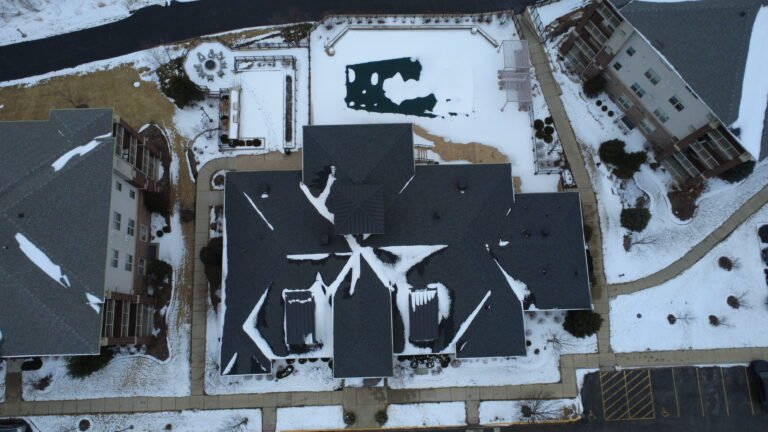
From the ground, a roof is rarely perceived as a single surface. Angles are limited, distance distorts perspective, and many areas remain out of view. Aerial imagery changes this dynamic by allowing the entire roof to be seen as one continuous system.
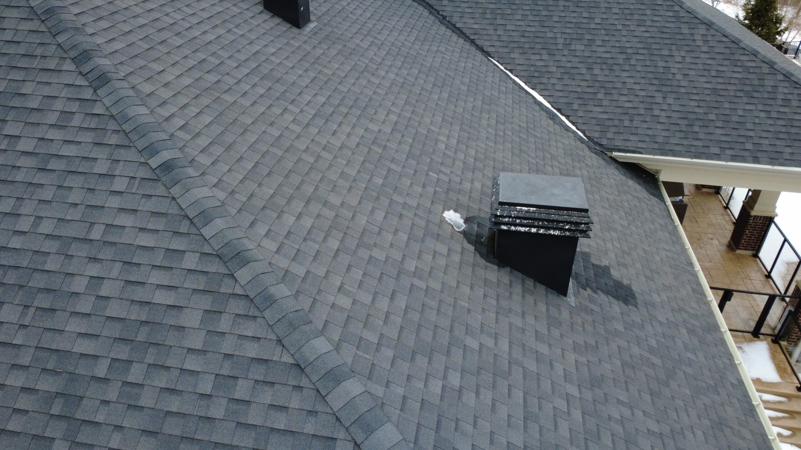
This top-down and oblique perspective reveals how different sections of the roof connect, where transitions occur, and how the overall surface behaves. For large commercial or industrial buildings, this is often the first time stakeholders truly see the roof in its entirety rather than as a collection of isolated zones.
Documenting Surface Materials and Visible Wear
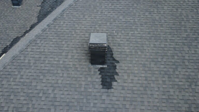
One of the most valuable outcomes of aerial roof imagery is the ability to document visible surface conditions with consistency. High-resolution photos make it possible to observe material continuity, surface texture, and areas that visually differ from the rest of the roof.
Discoloration, uneven wear, and surface irregularities often stand out more clearly from above than they do at ground level. When these variations are viewed in context, they provide important visual cues that licensed professionals can later interpret as part of their own evaluation processes.
Seams, Transitions, and Connection Points
Roofs are rarely uniform. Seams, joints, and transitions between materials or sections are inherent to most roofing systems. From an aerial perspective, these features become much easier to document systematically.
Rather than focusing on individual details in isolation, aerial imagery shows how seams and transitions are distributed across the roof and how they interact with slopes, drainage paths, and rooftop equipment. This broader context is often missing from ground-level photos, even when those photos are taken carefully.
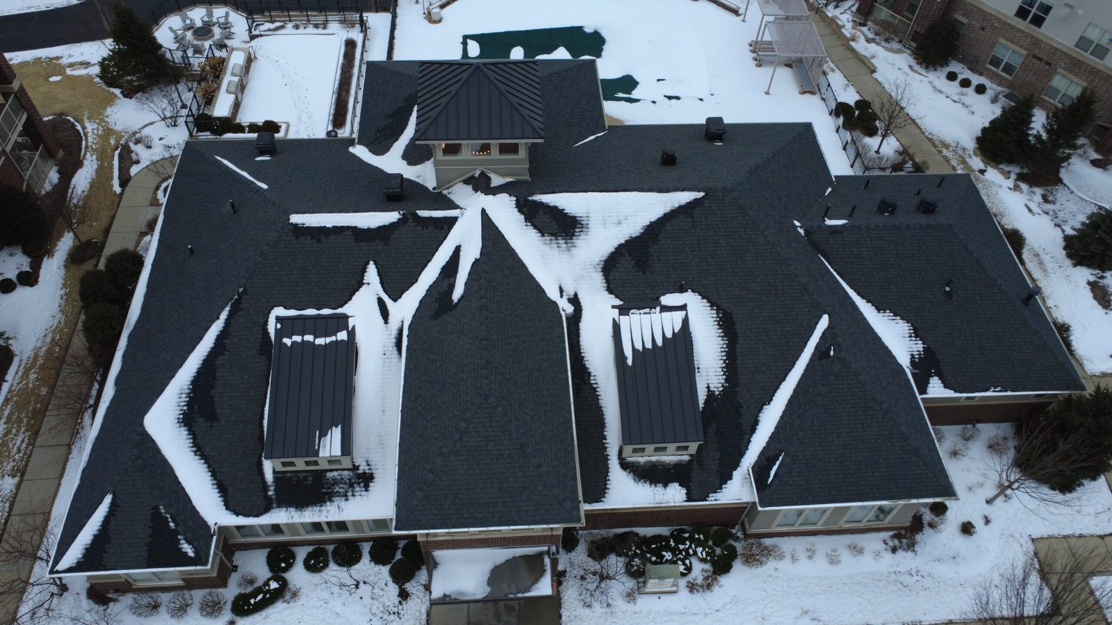
Drainage Behavior and Water Flow Patterns
Drainage is one of the areas where aerial imagery provides particularly strong insight. When viewed from above, slope direction and water flow paths become visually apparent. Areas where water tends to collect, linger, or drain slowly can often be identified without anyone needing to step onto the roof.
While aerial imagery does not measure moisture or confirm internal conditions, it provides a clear visual reference that helps professionals understand how the roof behaves during and after precipitation events.
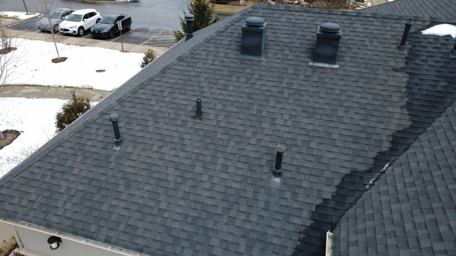
Rooftop Equipment and Spatial Relationships
Commercial roofs often host a variety of equipment, including HVAC units, vents, and other installations. Aerial imagery captures not just the presence of this equipment, but also its placement and spacing across the roof.
From this perspective, it becomes easier to understand access routes, congestion areas, and how equipment placement affects drainage and surface continuity. This spatial awareness is difficult to achieve through ground photos alone, especially on larger roofs.
Environmental Impact and Debris Accumulation
Environmental factors such as wind, nearby trees, and surrounding structures influence where debris accumulates on a roof. Aerial imagery highlights these patterns clearly, showing where leaves, dirt, or other materials tend to collect over time.
While debris itself may not indicate structural issues, documenting its location and extent provides useful context for maintenance planning and ongoing monitoring.
Understanding the Limits of Aerial Documentation
Despite its strengths, aerial imagery has clear limitations. It captures what is visible on the surface, but it does not reveal subsurface conditions. Issues such as internal moisture intrusion, insulation performance, or structural integrity require physical inspection and specialized tools.
Recognizing these limits is critical. Aerial imagery is most effective when it is understood as a visual foundation — not as a standalone diagnostic tool.
Why Clear Visual Documentation Matters
Clear visuals allow licensed professionals to work more efficiently. Instead of spending valuable time orienting themselves on-site, they can begin with a solid understanding of the roof’s layout and visible conditions.
For property owners and managers, this clarity leads to more informed conversations, fewer assumptions, and better alignment between all parties involved.
A Practical Layer in Roof-Related Workflows
Aerial roof imagery does not deliver conclusions. It delivers visibility. By clearly documenting what can be seen, it supports planning, communication, and professional judgment.
For many organizations, this visual layer has become an essential part of roof-related workflows — not because it replaces expertise, but because it allows that expertise to be applied with confidence.
Disclaimer
We provide aerial visual documentation only.
We do not perform inspections, evaluations, or certifications.
All professional assessments and conclusions are made by licensed specialists using the documented imagery.