Introduction
Construction projects generate an enormous amount of information. Schedules, drawings, reports, emails, and status updates move constantly between owners, contractors, consultants, and investors. Despite this flow of data, one problem remains surprisingly common: different stakeholders often have very different understandings of what is actually happening on site.
This disconnect rarely comes from a lack of effort. It comes from the absence of a shared, objective visual reference. That is why visual construction updates — especially those captured from the air — are increasingly becoming a single source of truth for construction teams.
Why Words and Reports Are Often Not Enough
Written updates and progress reports play an important role, but they rely heavily on interpretation. Phrases like “mostly complete,” “in progress,” or “awaiting next phase” can mean different things to different people. Even photographs taken from the ground may lack the context needed to fully understand site-wide progress.
Aerial visual documentation addresses this gap by showing the site as it actually exists at a specific moment in time. Instead of interpreting progress through descriptions, stakeholders can see it directly.
Seeing the Entire Site, Not Just Isolated Areas
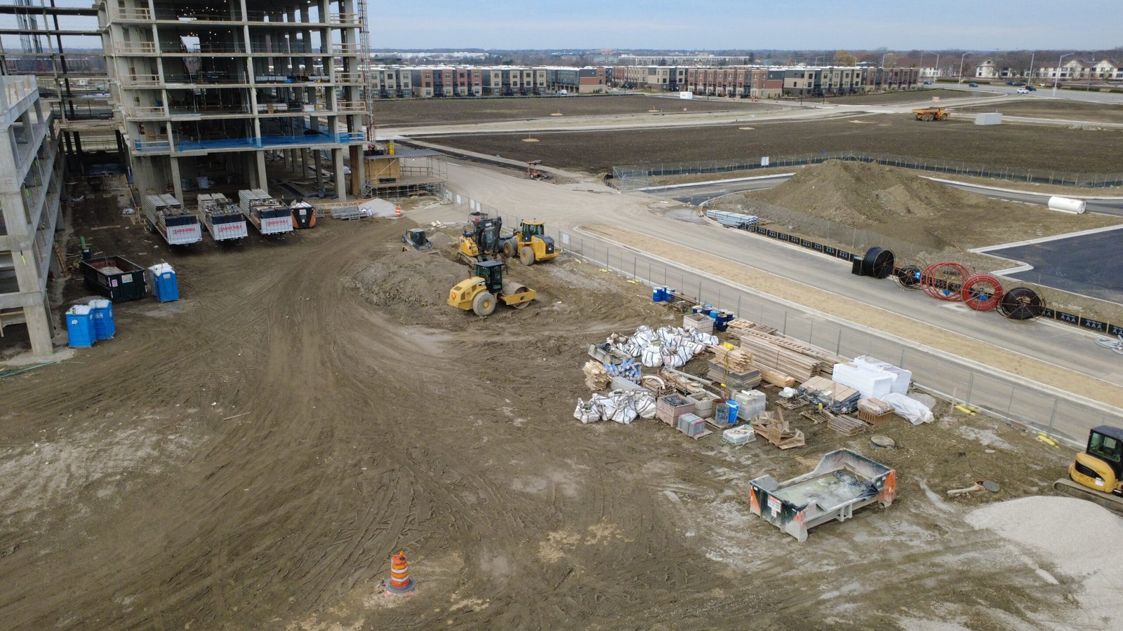
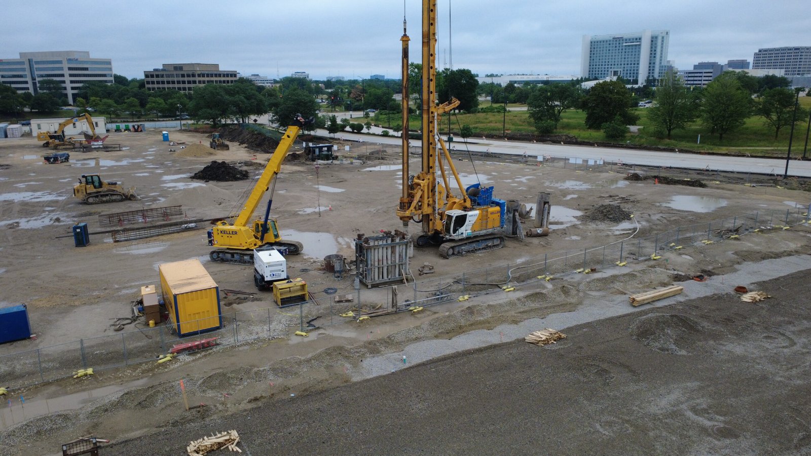
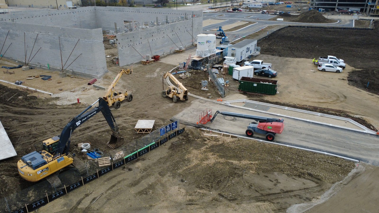
Construction sites are dynamic environments. Materials move, access routes change, and multiple workstreams often overlap. Ground-level photos tend to focus on specific tasks or zones, which can make it difficult to understand how the project is progressing as a whole.
Aerial imagery provides a comprehensive view of the site. From above, it becomes easier to see completed areas, active zones, and upcoming work. Relationships between different parts of the project are immediately visible, allowing everyone involved to understand progress in context rather than in fragments.
Creating a Shared Visual Reference
One of the most valuable aspects of visual construction updates is that they create a shared reference point. When all stakeholders review the same imagery, discussions become more focused and productive. Questions can be answered visually rather than speculatively.
This shared understanding reduces miscommunication and helps align expectations. Instead of debating interpretations of reports, teams can point to clear visuals that show exactly where the project stands.
Consistency Over Time Builds Trust
When aerial visuals are captured consistently, they form a visual timeline of the project. Progress can be tracked week by week or month by month using comparable viewpoints. Changes become obvious, and delays or accelerations are easier to understand.
This consistency is particularly valuable for owners and investors who may not visit the site regularly. Visual updates allow them to stay informed without relying solely on secondhand information.
Reducing the Need for Frequent Site Visits
Site visits are essential, but they are also time-consuming and sometimes disruptive. For remote stakeholders, they may be impractical on a regular basis.
Aerial visual documentation does not eliminate the need for site visits, but it reduces how often they are required. Many questions can be resolved by reviewing recent imagery, allowing in-person visits to be more focused and purposeful when they do occur.
Supporting Better Decision-Making
Clear visuals support better decisions. When teams can see current conditions, they are better equipped to plan next steps, adjust schedules, and allocate resources. Potential issues are easier to spot early, before they escalate into larger problems.
Rather than reacting to surprises, stakeholders can respond proactively, guided by up-to-date visual information.
Who Benefits From Visual Construction Updates
Project owners benefit from transparency and confidence in reporting. Contractors gain a clear way to demonstrate progress and manage expectations. Consultants and advisors can review conditions remotely and provide more informed input.
In each case, visual updates serve the same purpose: they replace assumptions with clarity.
A Single Source of Truth in a Complex Environment
A Practical Layer in Roof-Related Workflows
Construction projects are complex by nature, and no single tool can eliminate that complexity entirely. However, having a reliable visual reference simplifies communication and reduces friction between stakeholders.
When everyone is looking at the same up-to-date imagery, conversations shift from “What do you think is happening?” to “What should we do next?”
Final Thoughts
Visual construction updates are not about surveillance or control. They are about alignment. By providing an objective, shared view of the site, aerial imagery helps teams stay on the same page throughout the lifecycle of a project.
For many construction teams, this visual layer has become the most effective way to establish a single source of truth — one that supports transparency, trust, and better outcomes.